Conservation
Through Information.
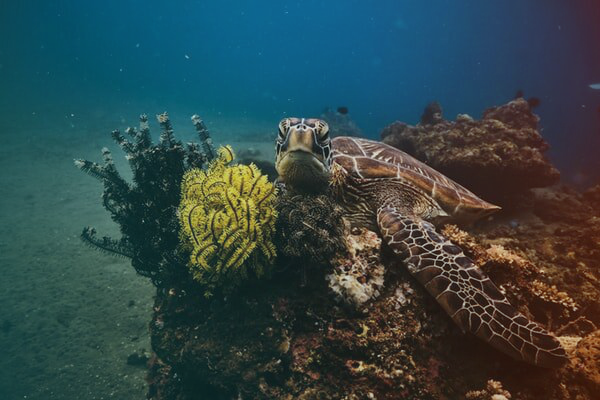
Roatan Marine Park.
Category, Location, and Limits.
The Bay Islands Marine Park (Parque National Marino de las Islas de la Bahia or "PNMIB") is located in the Caribbean of Honduras and is made up of the islands of Roatan, Utila, and Guanaja. This park was created on June 7 1997, under an Executive Agreement, and subsequently, with the objective of strengthening the functioning and protection of natural resources in the area.
The Roatan Marine park has a surface area of 47,152.49 ha and it is made up of these three parts:
Marine Zone.
Special Marine Zone (Zona Especial Marina "ZEM"): This area extends from the High Tide Line to the level curve of 60 m deep in the sea. This, in turn, is divided into 5 zones: ZPEM, ZRP, ZR, ZDE y ZUM. The Roatan Marine services the east end of Roatan through regular patrols.
Antiquity.
Area of antiquity: includes the area from the 60 m depth curve to 12 nautical miles along the coast of the Guanaja Islands, Roatan and Utila, respectively. With the only exception to the south of Utila Island which extends only 6 miles longitudinally from the Key Gannon.
Municipalities.
ZC: which comprises the 10 m strip within the island territory counted from the High Tide Line. Politically and administratively, the park is located in 4 municipalities, each with its own respective management areas throughout the island of Roatan.